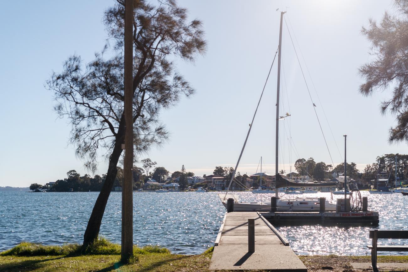
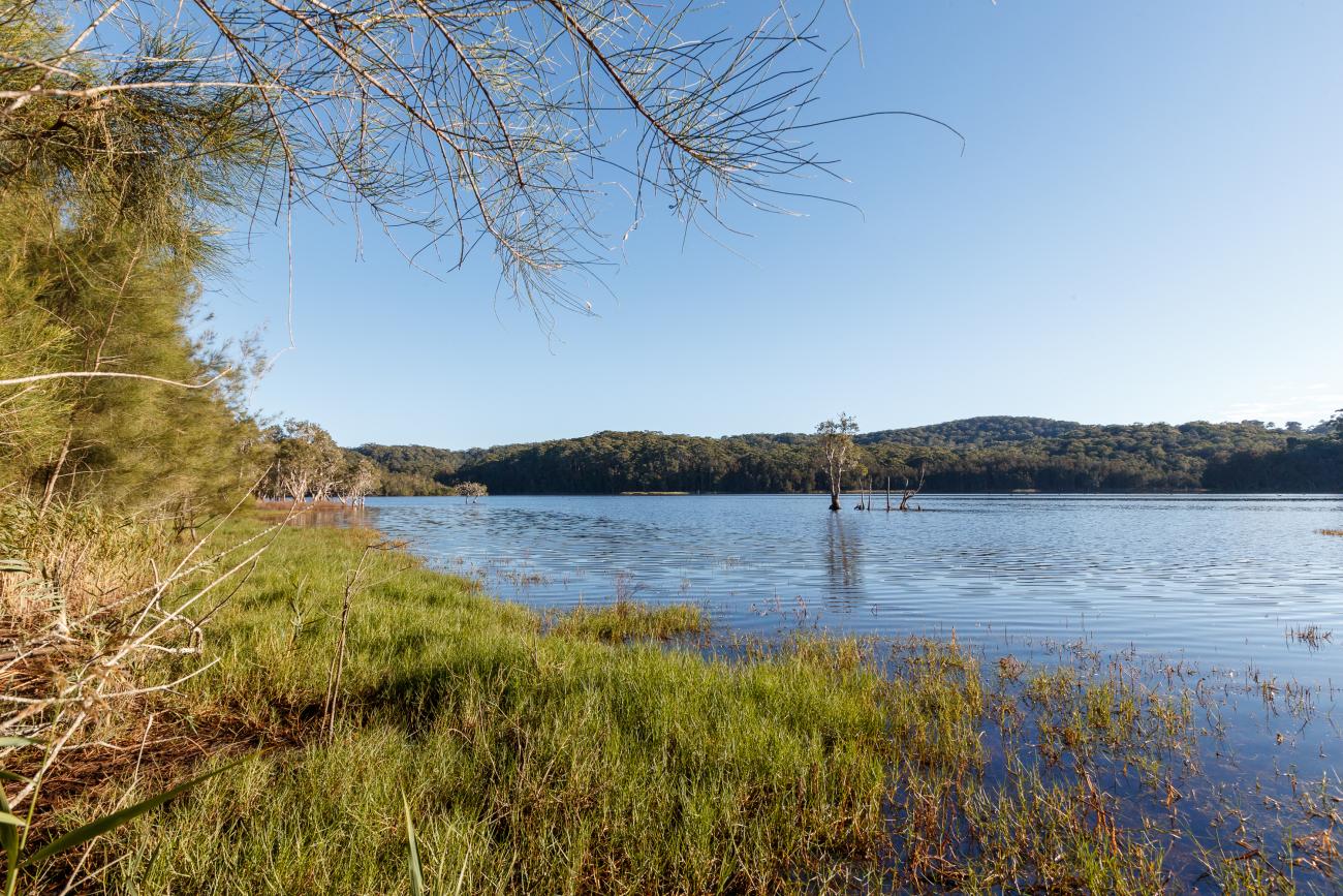
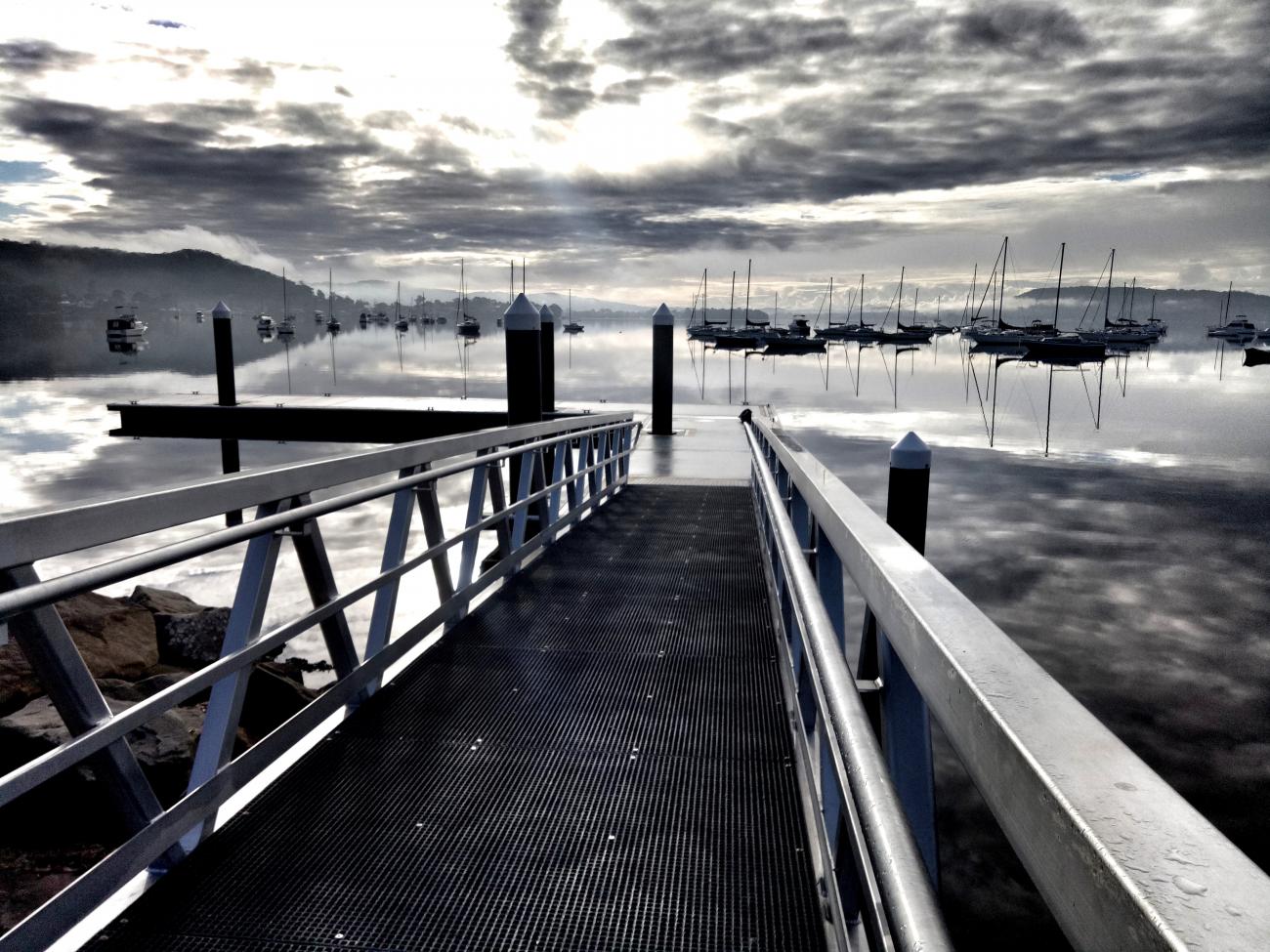
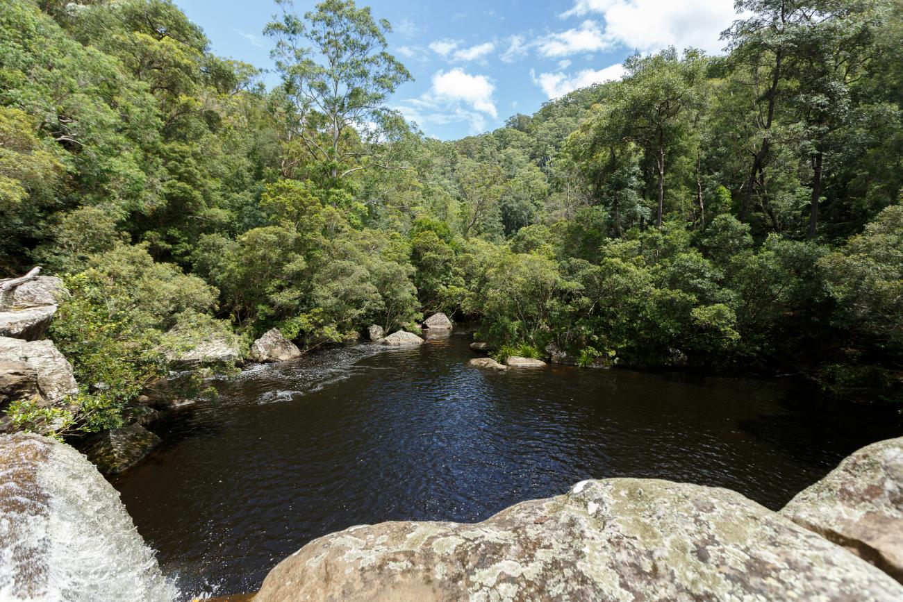
Coastal Lagoons
Our lagoons – Terrigal, Wamberal, Cochrane, and Avoca – are gems of the Central Coast, offering serene waters, awesome wildlife, and stunning views. But hey, they also need a bit of TLC due to all the love they get from our community and the pressures of development. So, let’s team up to keep the magic alive! Whether you're kayaking, bird-watching, or just chilling by the water, together we can make sure our lagoons stay vibrant and healthy for years to come.
We've decided to create a separate Coastal Management Program just for our lagoons! Their unique environments, vibrant communities, and specific needs deserve special attention. This program will ensure we can focus on preserving and enhancing these incredible natural treasures for everyone to enjoy.
We're not just planning for the future—we're inviting you to help co-design it! Your ideas and input are crucial as we enter Stage 3 of our program, where community engagement ramps up. Together, we can create a vibrant, sustainable future for our waterways.
Community Engagement so far:
Over the years we’ve heard you via:
• your participation in the development of existing Coastal Zone Management Plans.
• the feedback you submit on a weekly basis via our Customer Service Centres, emails etc.
• the waterways survey - view the Our Coast, Our Waterways survey results here.
• recent consultation to understand issues and management opportunities for our Lagoons.
All this information will be used to assist in informing the Open Coast and Coastal Lagoons Coastal Management Program.
Progress - Previous management plans:
Previous management plans for our Lagoons include the Coastal Zone Management Plan for Gosford’s Lagoons (Cardno 2015), associated with the Coastal Zone Management Study circa 2012/13. So far 65% of the previously adopted actions have been completed (or are ongoing actions). For the other 35%, it is anticipated that these actions will be carried over into the new Coastal Management Program were appropriate.
Progress – Stage 1 Scoping Study:
Stage 1 Scoping Study for the Open Coast and Coastal Lagoons was done as a combine study and has been completed and reviewed by Council and NSW DPIE staff. It Identified knowledge gaps, recommended Stage 2 studies and provided a forward program for next Stages.
Progress – Stage 2 Technical Studies:
We were awarded a Coast and Estuary grant worth $327,000 from the NSW State Government to allow us to complete the studies needed as the second stage of the CMP development process for both the Open Coast and Coastal Lagoons CMPs.
The first study we completed was a Social and Recreational Use Study to understand the recreational use and recreational infrastructure along our coastline and lagoons and provide a comprehensive series of recommendations for consideration in the development of the new Coastal Management Program.
We have also now completed the Avoca Lagoon Process Study, Green and Golden Bell Frog population studies and Bareena Wetland Hydrological Study which you are welcome to read here.
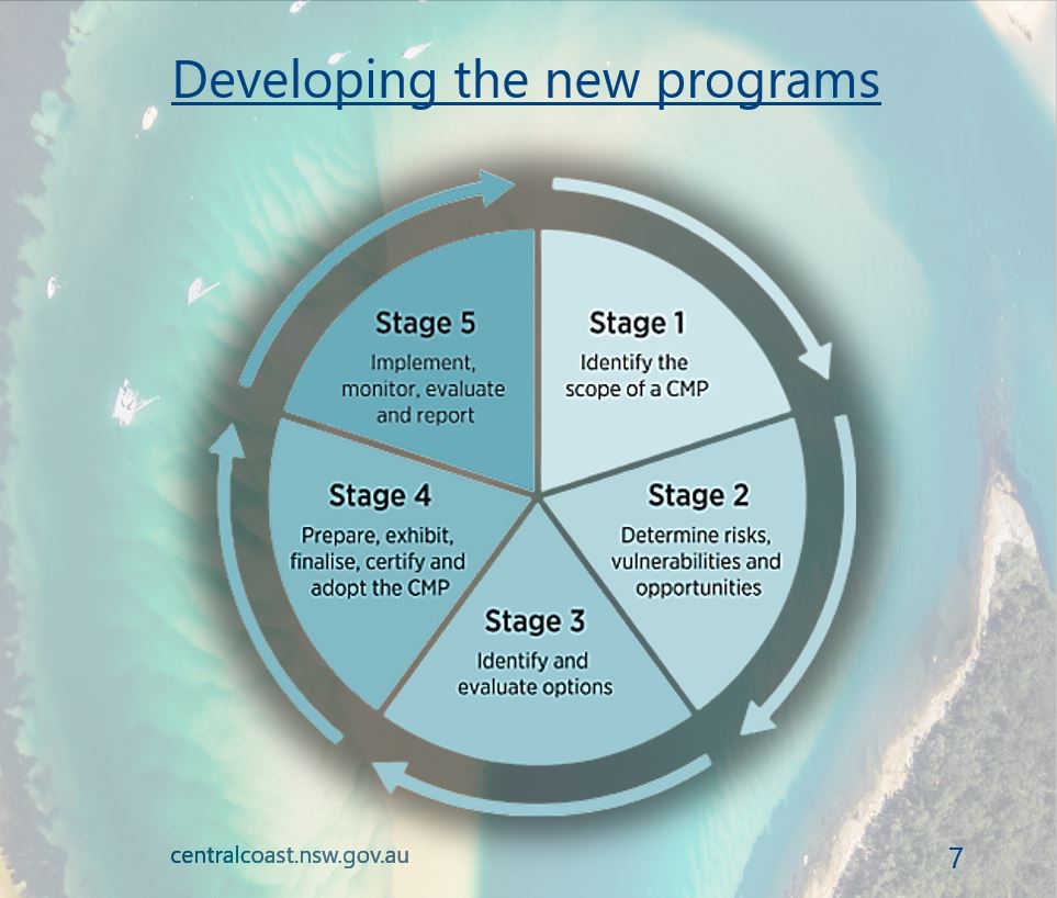
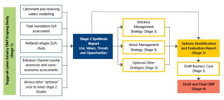
Stage 3 Options Assessment:
Stage 3 is all about using existing information and recommendations from stage 2 studies to develop an options assessment, shaped by community consultation. The aim is to identify and evaluate possible management options in order to develop the best management program, guided by scientific evidence and community values.
Links
Segmented Documents
Stage One Scoping Study
Stage Two Technical Studies
Timeline
Who's listening
Coastal Management Programs
Waterways are a huge part of the Central Coast community’s lifestyle. They underpin our identity, support our local economy, provide recreational and social opportunities for locals and visitors and support our mental and physical wellbeing. They provide the water we drink and the air we breathe, and our health is as dependant on them as theirs is on us. In addition to the values and benefits Central Coast Waterways offer us, they are important in their own right and have significant ecological and intrinsic value which should be managed both now, and into the future.
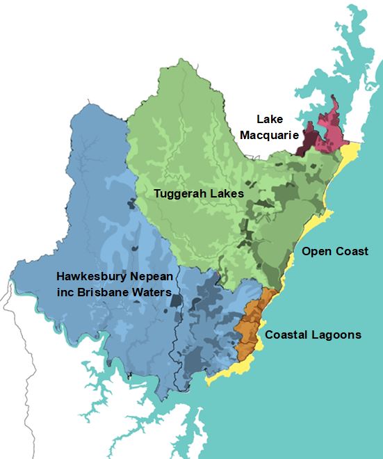
In accordance with the NSW Coastal Management Framework, Central Coast Council is required to develop Coastal Management Programs (CMPs) for our part of the NSW Coast (excluding National Parks estate). Acknowledging the size and diversity of the coastal zone of the Central Coast, Council are involved in the development of 5 CMPs:
- Tuggerah Lakes
- The Open Coast
- Coastal Lagoons
- Hawkesbury-Nepean River including Brisbane Water (multi-council collaboration)
- Lake Macquarie (collaboration with Lake Macquarie City Council)
These new management programs will be valid for 10 years and replace various previous management plans which are now out of date. The process of re-doing these programs every 10 years is not only a NSW State Government requirement, but something we believe is important to ensure our projects reflect the latest advances in technology and ecology, and account for changes in the pressures and desires of our community.
Community Engagement so far:
Over the years we’ve heard you via your participation in the development of existing Coastal Zone Management Plans, the feedback you submit on a weekly basis via our Customer Service Centres, emails etc and the Stage 1 waterways survey.
- View the Our Coast, Our Waterways survey results here.
The next stages of consultation are being undertaken specific to each of the 5 CMPs. Please use the tabs at the top of this page to navigate to each for further details.
Our waterways need us, and we must develop these plans - we don’t want to exclude your important views so let us know what matters to you.
.jpg?itok=_7bPWlkb)
Links
Segmented Documents
Consultation results
Timeline
Who's listening
Open Coast
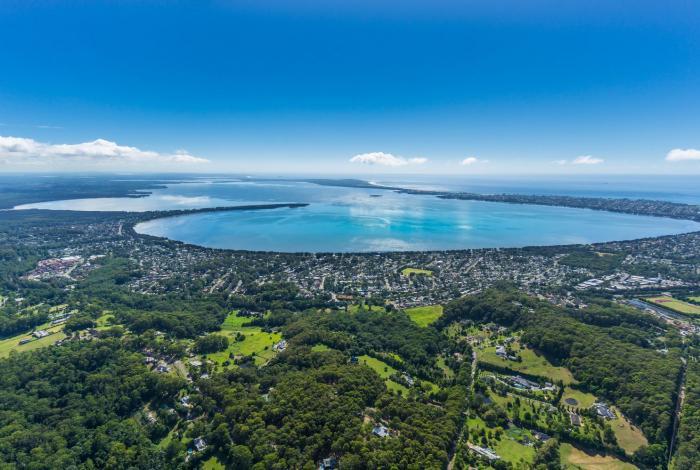
Tuggerah Lakes
We get it! Another plan/study/document for Tuggerah Lakes is not ideal but we do have to develop this program as it’s legislatively required. The good news is that we are not starting from scratch!
Over the years we’ve heard you via:
- your participation and work with the Tuggerah Lakes Expert Panel
- the feedback you submit on a weekly basis via our Customer Service Centres, emails etc.
- feedback you have provided during consultation opportunities across Council.
All this information will be used to assist in informing the Tuggerah Lakes Coastal Management Program. As part of the phase one consultation we also conducted a waterways survey which will assist us in plugging the gaps identified and to more broadly understand how you are using our waterways and why - the survey report is available here.
What we have achieved
Over the years there has been a lot of plans, studies and recommendations provided for the management Tuggerah Lakes and you’ll be happy to know that over 86% of the adopted actions have been completed or are ongoing. Further information on these actions and Councils work to date can be found:
- in the Implementation Report
- on the map of projects
- detailed in the Central Coast Waterways Report Card
- at the Love our Waterways education website
- and in the Tuggerah Lakes Estuary Management Plan
Fear not for the other 14%, it is anticipated that these actions will be carried over into the new Coastal Management Program. A new CMP also provides a great opportunity for us to work together to redefine our priorities and change tack if needed, so watch this space!
Stage One Scoping Study
The Stage One Scoping Study is now available in the document library on this page!
Council have used the feedback you provided to inform the development of the Stage 1 Scoping Study which is the first step in developing the new Coastal Management Program for Tuggerah Lakes.
The Scoping Study provides a useful guide for Council and state government to work together to achieve the strategy, vision and objectives for Tuggerah Lakes. It includes a summary of the strategic, environmental, heritage and future contexts, identifies the purpose and maps out a series of forward planning tasks to fill key knowledge gaps.
The Scoping Study provides important information such as risk assessments to prioritise key issues and threats which will allow Council to establish an effective and implementable management program.
As we continue our journey to develop a comprehensive and thorough Coastal Management Program for Tuggerah Lakes, we remain committed to working collaboratively with you to co-create clear, realistic and measurable actions that work towards a shared vision.


Links
Tuggerah Lakes Expert Panel Report
Stage One Scoping Study
Stage Three Strategies
Timeline
Who's listening
The overarching objective of the Tuggerah Lakes Estuary CMP is to provide a long-term strategy and short-term actions to manage the estuary in an ecologically sustainable manner, for the benefit of the wider community.
Specifically, the CMP aims to:
- Maintain and improve the ecological health of the estuary and its coastal environment, by protecting the natural processes, natural variability, environmental assets, ecosystem integrity and water quality of the estuary;
- Support community connection with and use of the estuary, in an ecologically sustainable and culturally sensitive manner;
- Improve co-ordination of public authorities that manage the estuary waterway and its catchment;
- Identify areas for improved management and facilitate good decision making
- Acknowledge the cultural value and indigenous use of the system and protect areas and items of cultural heritage significance;
- Align coastal management planning with regional planning, and vice versa
- Manage coastal and climate risks proactively, strategically and with consideration of future generations
- Collaborate with government and community to manage the estuary system and its catchment, through improving collective knowledge and understanding, capacity building, and collective action.
- Support the overarching strategy for coastal management, objects of the Coastal Management Act 2016 and Marine Estate Management Act 2014.
The Tuggerah Lakes catchment is around 790km2 and takes in the plateaus of Kulnura and Somersby the river valleys of Dooralong, Yarramalong and Ourimbah and the floodplains wrapping around the waterway from Lake Munmorah to Bateau Bay. In recognition of the significance these areas play in the health and function of the estuary, the CMP will apply to the whole catchment area, not just the defined coastal areas.
Changes in legislation require coastal councils to prepare Coastal Management Programs. The new legislation will no longer support the former Coastal Zone Management Plans (CZMPs) or Estuary Management Plans (EMPs) beyond December 2021. The Tuggerah Lakes Estuary Management Plan has guided Council’s management of the estuary and catchment for over a decade with significant progress made on 86% of the actions during this time. The intended life of a CZMP/ EMP is around 10 years, so was time to prepare a new plan anyway. The good news is we won’t be starting from scratch. We will use the EMP, Tuggerah Lakes Expert Panel report and other research and studies to guide this new plan.
We understand there are many studies and plans for Tuggerah Lakes. It is a complex estuary and its management has been of keen interest to the community for many decades. The Tuggerah Lakes Estuary Management Plan is the current certified Coastal Zone Management Plan for Tuggerah Lakes. It was prepared in accordance with the relevant NSW Legislation at the time. Like the EMP, the Tuggerah Lakes Estuary Coastal Management Program aims to bring all of these past studies together and provide an evidence-based strategic way forward. The CMP provides an opportunity to revisit our priorities and work with all stakeholders to outline a direction for managing:
- the ecological health of the estuary and its catchment,
- coastal threats and risks, and
- competing community visions for the estuary.
Council will be using the CMP as a vehicle to better engage with the community and develop coastal management solutions, collaboratively.
86% of the identified actions in the Tuggerah Lakes Estuary Management Plan have been completed or are ongoing. A detailed summary report is available here. Outstanding actions will be revisited as part of the development of the CMP.
The Tuggerah Lakes Expert Panel was appointed by the NSW Government in mid-2020 to undertake an independent review of the management of Tuggerah Lakes with respect to water quality. The panel’s report was released to the public in May 2021. Council intends to integrate the findings of the report into the CMP where appropriate and feasible. Council worked directly with members of the panel in development of the Scoping Study including the first pass risk assessment, forward plan and community and stakeholder engagement strategy.
You can view the report here.
What are the recommendations from the Tuggerah Lakes Expert panel?
In 2020 the NSW Government created an independent Expert Panel in response to community concern over water quality. The Expert Panel have produced a report containing over 50 recommendations which we have welcomed and made genuine effort to holistically integrate into the development of our new Coastal Management Program. 23 recommendations are considered to be fully, and 21 recommendations are partly achievable through this process.
Yes. The CMP will integrate existing management strategies, review these where necessary and include detailed guidance on how best to manage the entrance channel.
Council’s Administrator, Dick Persson commissioned a review of The Entrance channel management plans. This is an independent review and is being conducted by international expert Mr Angus Gordon.
The report is available here.
No. Flooding is managed in accordance with the NSW Government’s Floodplain Management Program through the development and implementation of Floodplain Risk Management Plans. The CMP will have regard for these plans, and where overlap exists, will ensure there are no discrepancies in management recommendations and actions. For more information on flooding around Tuggerah Lakes and preparing for floods, please visit our website.
The Tuggerah Lakes Estuary Management Plan included four action plans relating to water quality, ecology, socio-economic values and knowledge and management. These action plans included 100 individual actions, of which 86% have been completed or are ongoing.
By working with our project partners and the local community, the following key achievements have been completed (as of June 2020):
- 40km rural stream rehabilitation
- 13km urban stream rehabilitation
- 2.5ha saltmarsh reconstruction
- 29ha saltmarsh rehabilitation
- 374ha wetland conservation and restoration
- 277 gross pollutant traps
- 37 constructed wetlands
- Collection and removal of approximately 10,000m3 of seagrass wrack and macroalgae per annum
- Removal of approximatelt 1000T of litter and sediment from pollutant traps per annum
- 29km of shared pathway
- 32 boat ramps & jetties
- 4 foreshore beaches
- 33 regional and local playspaces and fitness stations
- Ongoing financial support for Environmental Groups (formerly Landcare)
- Award winning community education program
- Long term water quality improvement at multiple locations
- Extensive research & innovation to improve future management
Even whilst we prepare this new plan, we are still working to improve the estuary and catchment in high priority locations. You may not always see where we are working, so instead why not explore the many on-ground works completed during the implementation of the EMP. The map contains locations and information on projects completed by Council and its partners through various grant programs as well as Council funded projects.
Yes. Wrack management is hugely important to our community from an aesthetic and recreational point of view and when done in a strategic manner, can help to improve water quality as well. Whilst we acknowledge that seagrass, wrack and macroalgae play an important part on the ecology and habitat value of the estuary, and have always been part of the estuary, improved wrack management will be a key feature of the CMP.
Yes. The CMP will integrate existing management strategies, review these where necessary and include detailed guidance on how best to manage opening of the entrance channel.
Land and waterways areas are owned and/or managed by a number of different government agencies, private individuals and other organisations. In practice, Central Coast Council has been at the forefront of planning and management of the Tuggerah Lakes coastal zone and catchment land since the completion of the Tuggerah Lakes Estuary Management Plan (EMP) in 2006. Management efforts by Council over the past decade or more have been supported (and heavily reliant) on the Federal Government grants which cover some, but not all actions identified in the EMP (e.g. Caring for our Country (2008-13), National Landcare Programme (2014-17), Improving your Local Parks and Environment (2017-20) and Environment Restoration Fund (2020-23).
The CMP provides a framework for establishing clear ongoing governance arrangements for the estuary and relevant government agencies must have regard for the content of a CMP.
Council has a water quality monitoring program in place for all its waterways, including Tuggerah Lakes. Monthly sampling of Tuggerah Lakes has been underway since 2011-12. These programs help to understand past and current condition, identify where we need to focus our management actions and determine long-term trends in water quality and ecological health.
Sampling is undertaken by scientists throughout the year at a number of representative sites. Data is collected on site condition, water chemistry, nutrient concentrations and a range of biological indicators which tell us about the health and resilience of each area. The program aligns with the NSW Estuary Monitoring, Evaluation and Reporting Protocols and allows us to compare our results to other estuaries in NSW.
The 2019-20 Waterways Report Card for the Central Coast Local Government Area has been released and includes Southern Lake Macquarie, Tuggerah Lakes, Brisbane Water, the Lower Hawkesbury River and the coastal lagoons – providing a clear picture of our entire waterways network. The 2019-20 report tells us:
- Of the 36 sites sampled, 25% are excellent, 39% are good, 33% are fair and 3% are very poor
- Brisbane Water estuary is generally considered good or excellent, with fair ratings at Narara Creek, Erina Creek and Kincumber Broadwater
- Water quality throughout the Tuggerah Lakes estuary was generally good, with fair results for Budgewoi Lake, Wallarah Creek, Canton Beach, Ourimbah Creek and Killarney Vale and an excellent rating for Chittaway Bay
- The water quality at our southern Lake Macquarie sites is excellent
- Our coastal lagoons vary from excellent at Cockrone Lagoon to very poor at Avoca Lagoon.
Council uses this information to track change, help guide our management decisions and identify areas where more detailed catchment audits are required.
Where is the funding to Develop the Tuggerah Lakes Coastal Management Program coming from?
Various opportunities for funding are available to prepare and implement the new management plan, including the NSW Government Coastal and Estuary Grants Program which is typically allocated on a 2:1 basis so Council only need to provide one-third funding. Our application for funding through the Coastal and Estuary Grant was successful and we have been awarded $644,560 to complete stages two and three of our Coastal Management Program for Tuggerah Lakes Estuary
You may also be interested in
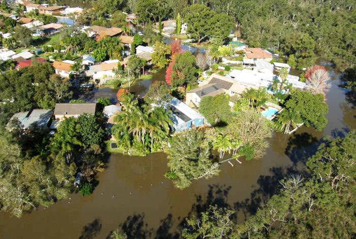

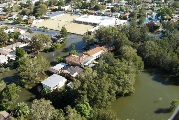
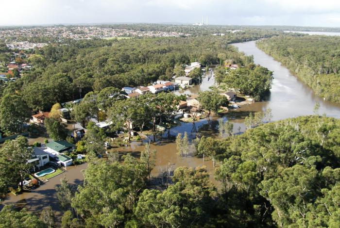


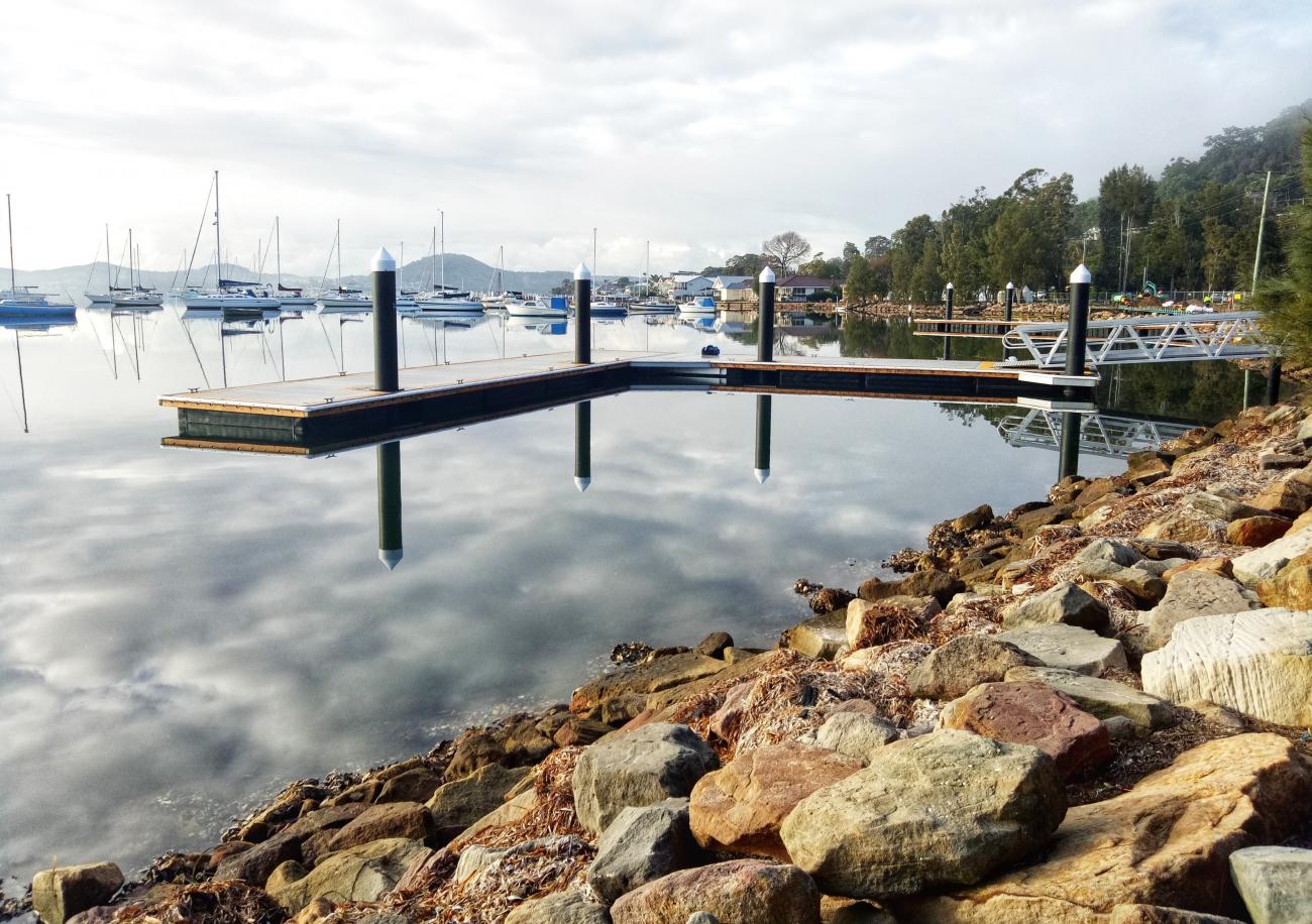
Hawkesbury-Nepean River system including Brisbane Water

Hawkesbury Nepean River Coastal Management Program
The Hawkesbury-Nepean River system which includes our beloved Brisbane Water is a massive body of water, so much so that it requires management by five other Councils (six, if you include Central Coast Council) and the catchment area extends into 18 wider Local Government Areas.
It’s massive and requires a huge amount of collaboration between the six Councils and more than 20 different state government departments. Luckily, we’re all great collaborators and equally love our waterways.
Your Voice Matters! Stage 3 Engagement Now Open
If you care about the Hawkesbury-Nepean River, including Brisbane Water, we want to hear from you. This is your chance to shape how our waterways are managed for the future.
Our Community Engagement period is open from Monday, 16 September, to Sunday, 24 November.
How Can You Get Involved?
Online Engagement Portal:
• Share Your Ideas: Suggest potential management actions for the CMP.
• Give Your Feedback: Learn about the management actions proposed by our project team and provide your feedback.
• Explore Issues Big and Small: Zoom into your area of interest and provide ideas and feedback about local issues. You can also see what’s happening right across the river system.
• Need Help? Check out our brief instructions or watch a quick demonstration video to get started.
Community Drop-In Sessions:
Meet the Team: Join us at one of our drop-in sessions across the river system. You can turn up at any time during the drop-in window to have a chat with our project team, learn more about the project, and share your input.
Hardys Bay - 21st September 10am - 1pm
58 Aruluen Dr, Hardys Bay
Wisemans Ferry - 3rd October 9am - 2pm
Wisemans Ferry Boat Ramp, Old Northern Road, Wisemans Ferry
Spencer - 11th October 3pm - 6pm
Dunkirk Hotel, 4666 Wisemans Ferry Rd, Spencer
Woy Woy - 13th October 9am - 4pm
Woytopia @ Woy Woy South School, 14 Waterloo Ave, Woy Woy
Umina - 20th October 9am - 2pm
Umina Beachside Markets, Sydney Ave, Umina
Erina - 24th October 9am - 9pm
Erina Fair, outside Shaver Shop, 620 Terrigal Dr, Erina
Phegans Bay - 26th October 9am - 12noon
The Bays RFS Brigade, 17 Wattle Cres, Phegans Bay
Patonga - 2nd November 9am - 12noon
Patonga Wharf (Blues across the Bay), 12 Patonga Drive, Patonga
Woy Woy -10th November 10am - 4pm
Brisbane Water Oyster Festival, Lions Park, 2 N Burge Rd, Woy Woy
Gosford - 12th November 9am - 1pm
Lakes Festival Cleanaway, Kibble Park, 118 Donnison St, Gosford
Woy Woy - 16th November 4 pm - 10pm
Lakes Festival Gather & Groove, Lions Park, 2 N Burge Rd, Woy Woy
Gosford - 24th November 9am - 12noon
Lions Park, 10 Masons Parade, Gosford
Stage One Scoping Study
Stage 1 of the HNRS CMP got finalised in April 2020 and resulted in the development of a Scoping Study that has reviewed past management of the river system, developed a shared understanding of the current situation and identified the strategic path for the remaining CMP stages. This study involved collation of existing information, preliminary risk assessment, community consultation strategy, and scoping of technical studies to fill key information gaps.
Stage Two Technical Studies
We developed a range of studies designed to assess key risks, vulnerabilities and identify opportunities to inform future management. These studies were selected for completion by the CMP project team because they addressed the most pressing knowledge gaps as identified in the Scoping Study and were essential for the successful progression of the CMP. This phase involved community engagement, confirmation of key issues and concerns, fieldwork to confirm current knowledge, and completion of identified technical studies to fill key information gaps. Stage 2 got finalised in March 2023 with the completion of five technical studies.
Stage 3 Options Assessment
The project is now transitioning into Stage 3 that will collate the information produced as part of Stages 1 and 2 and use a more complete picture of estuarine processes and relevant management issues to guide the identification, evaluation and selection of appropriate management actions to guide the management of the River system over the next 10 years.
What we have achieved
Over the years, each of the Councils have heard from our various communities through:
- the development of the Brisbane Water Coastal Zone Management Plan and Pearl Beach Lagoon Coastal Zone Management and Lower Hawkesbury Estuary Management Plan
- the feedback you submit on a weekly basis via our Customer Service Centres, emails etc.
- feedback you have provided during consultation opportunities across Council.
We recently conducted a waterways survey which will assist us in plugging the gaps identified and to more broadly understand how you are using our waterways and why - you can view the Our Coast, Our Waterways survey results here!
Up until now, each of the Councils had their own plans and were responsible for delivering the actions in these plans. 88% of the adopted actions have been completed (or are ongoing actions) in the Brisbane Water CZMP, Pearl Beach Lagoon CMP and Lower Hawkesbury EMP. Further information on these actions and Councils work to date can be found at:
- at the Love Our Waterways education website
- on the Davistown Wetland Restoration Works page
- on the Saratoga Wetland Restoration Works page
- on the Bensville Wetland Restoration Works page
- on the boating page on Councils website
For the other 12%, it is anticipated that, were appropriate, these actions will be carried over into the new Coastal Management Program.


Links
Segmented Documents
Fact Sheets
Community Engagement
Stage One Scoping Study
Stage Two Technical Studies
Scoping Study Summary
Timeline
Who's listening
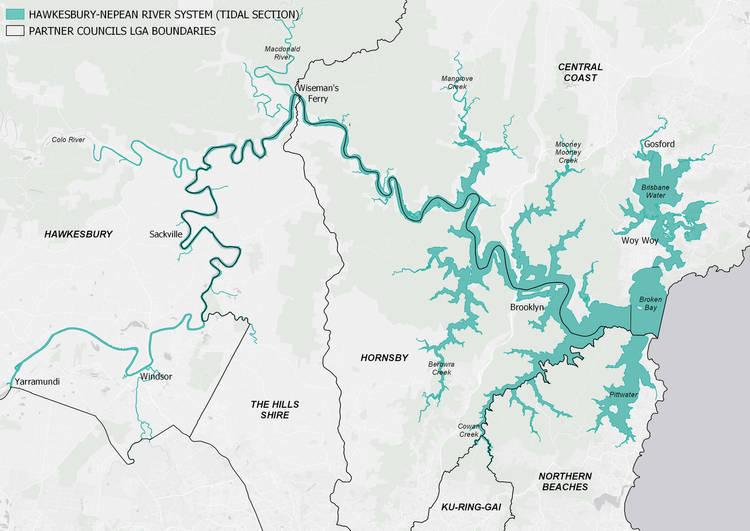
The Hawkesbury-Nepean CMP covers the entire tidal and estuarine reach of the Hawkesbury-Nepean River and associated estuaries including Brisbane Water, Broken Bay and Pittwater. This covers the Local Government Areas of the Central Coast, Northern Beaches, Ku-ring-gai, Hornsby, The Hills and Hawkesbury.
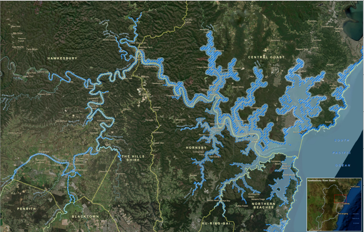
Under the CM Act, councils are required to take a systems approach to coastal management looking at coastal zone management issues in the broader, catchment scale context. The tidal and estuarine reaches of the Hawkesbury-Nepean River system extend from the confluence of the Grose River at Yarramundi 145km downstream to Broken Bay intersecting 6 Local Government Areas. In order to consistently and effectively address system-wide issues, it is important that the 6 local councils with management jurisdiction of the river system work together and that one program is prepared to guide this process.
Central Coast is partnering with Northern Beaches, Ku-ring-gai, Hornsby, The Hills and Hawkesbury Councils to develop a whole-of-system CMP for the tidal reaches of the Hawkesbury-Nepean River System. The CMP will contain actions that address both system wide processes as well as LGA specific actions that address local scale issues which will need to be dealt with by the individual council for example Brisbane Water specific actions would need to be addressed by Central Coast Council.
The CMP will be presented as a compendium of implementation plans covering system-wide actions and LGA specific actions to ensure that there is sufficient granularity to address issues at different scales.
A website which collates the information from all six partnering councils has been developed and is available here.
The broad objectives of the HNR CMP are stated below however it is anticipated that they may be refined during the development of the CMP to reflect stakeholder and community feedback.
- to protect and enhance the integrity and resilience of the environmental values of the Hawkesbury River, Brisbane Water and Pittwater estuaries, including healthy, diverse aquatic ecosystems.
- to maintain and protect water quality across the system and its impacts on environmental, social and economic values - including ecological condition, recreational amenity and agricultural uses;
- to maintain and preserve the unique scenic amenity and natural character of the Hawkesbury River, Brisbane Water and Pittwater estuaries;
- to support the social and cultural values of the system and maintain public access and recreational amenity;
- to maintain the health, safety and wellbeing of those using the coastal zone (both directly and indirectly) - and to protect the health of human consumers of aquatic foods;
- to acknowledge Aboriginal peoples’ spiritual, social, customary and economic use of the Hawkesbury and to protect local indigenous cultural heritage;
- to recognise the coastal zone as a vital economic zone and to support sustainable coastal economies such as recreational fishing, aquaculture and tourism;
- to facilitate appropriate management of the coastal zone through ecologically sustainable development, and the promotion of sustainable land use planning and decision-making that is consistent with regional and local strategic plans;
- to mitigate current and future risks from population growth, urbanisation and coastal hazards (erosion and inundation of foreshores caused by tidal waters and the action of waves, including the interaction of those waters with catchment flooding);
- to ensure co-ordination between relevant government and public authorities relating to the river system - and to facilitate the proper integration of management activities across all levels of government;
- to maintain meaningful engagement with the community, and to support public participation in coastal management and planning, and to create greater public awareness, education and understanding of coastal processes and management actions;
- to encourage and facilitate research and monitoring – and to maintain the scientific and educational values of the river system;
- to support the objects of the Marine Estate Management Act 2014; and
- to align with the NSW Risk-based Framework for Considering Waterway Health Outcomes in Strategic Land-use Planning Decisions.
Yes. The Lower Hawkesbury River Estuary Management Plan was developed in 2008 by Hornsby Council in collaboration with Gosford Council. In addition to this there are 3 existing Coastal Zone Management Plans relevant to the study area including:
The Coastal Zone Management Plan for Brisbane Water (adopted by Gosford City Council in 2012);
The Coastal Zone Management Plan for Gosford’s Beaches (certified by the Minister for the Environment in 2017); and,
The Coastal Zone Management Plan for Pearl Beach Lagoon (certified by the Minister for the Environment in 2017).
There are 6 councils with management jurisdiction over the tidal reaches of the Hawkesbury-Nepean River System:
- Central Coast Council
- Northern Beaches Council
- Ku-ring-gai Council
- Hornsby Shire Council
- The Hills Shire Council
- Hawkesbury City Council.
There are 6 councils with management jurisdiction over the tidal reaches of the Hawkesbury-Nepean River System:
- Central Coast Council
- Northern Beaches Council
- Ku-ring-gai Council
- Hornsby Shire Council
- The Hills Shire Council
- Hawkesbury City Council.
The HNR CMP will be delivered by the project steering committee which consists of representatives from the NSW Department of Planning, Industry and the Environment and from each of the 6 partner councils.
A website which collates the information from all 6 partnering councils has been developed and is available here.
Council has a water quality monitoring program in place for all its waterways, including Brisbane Water and the Lower Hawkesbury River. Sampling of these areas began in 2017-18 (Brisbane Water) and 2018-19 (Hawkesbury River). These programs help to understand past and current condition, identify where we need to focus our management actions and determine long-term trends in water quality and ecological health.
Sampling is undertaken by scientists throughout the year at a number of representative sites. Data is collected on site condition, water chemistry, nutrient concentrations and a range of biological indicators which tell us about the health and resilience of each area. The program aligns with the NSW Estuary Monitoring, Evaluation and Reporting Protocols and allows us to compare our results to other estuaries in NSW.
The 2019-20 Waterways Report Card for the Central Coast Local Government Area has been released and includes Southern Lake Macquarie, Tuggerah Lakes, Brisbane Water, the Lower Hawkesbury River and the coastal lagoons – providing a clear picture of our entire waterways network. The 2019-20 report tells us:
- Of the 36 sites sampled, 25% are excellent, 39% are good, 33% are fair and 3% are very poor
- Brisbane Water estuary is generally considered good or excellent, with fair ratings at Narara Creek, Erina Creek and Kincumber Broadwater
- Water quality throughout the Tuggerah Lakes estuary was generally good, with fair results for Budgewoi Lake, Wallarah Creek, Canton Beach, Ourimbah Creek and Killarney Vale and an excellent rating for Chittaway Bay
- The water quality at our southern Lake Macquarie sites is excellent
- Our coastal lagoons vary from excellent at Cockrone Lagoon to very poor at Avoca Lagoon.
Council uses this information to track change, help guide our management decisions and identify areas where more detailed catchment audits are required.
Lake Macquarie
Lake Macquarie laps on the shore of our most northern suburbs, often described as the forgotten North, but we want to make sure that’s not the case. We love all the waterways, both within our LGA and around them and Lake Mac is no exception.
The Lake Macquarie Coastal Management Program (CMP) has been developed by Lake Macquarie City Council and whilst Central Coast Council is not directly responsible for its development, we’ve certainly been involved and will continue to be involved as the CMP moves into implementation.
Thank you for sharing what you value and consider success to look like for Lake Macquarie through our community consultation. We have published the results and key findings of our consultation in this Summary Report and shared this important information with Lake Macquarie City Council. Your local knowledge goes a long way in helping us coordinate the actions that we need to implement for the long-term good health of Lake Macquarie!
The Lake Macquarie Coastal Management Program was certified by the NSW Minister for the Environment on 26 September 2023. It outlines 114 actions to be taken over the next 10 years to protect our coastal zone from the risks of our changing climate and increasing urban density.
It has been developed over three years, in consultation with a range of stakeholders including agencies such as Transport for NSW, Hunter Water, NSW Department of Planning and Environment, and NSW Department of Primary Industries, as well as universities, other local governments and regional environmental and community groups. The Community Engagement Plan, Stage 1 Scoping Study and all other plans and assessments are in the Appendices document here. You can view the final certified CMP here.